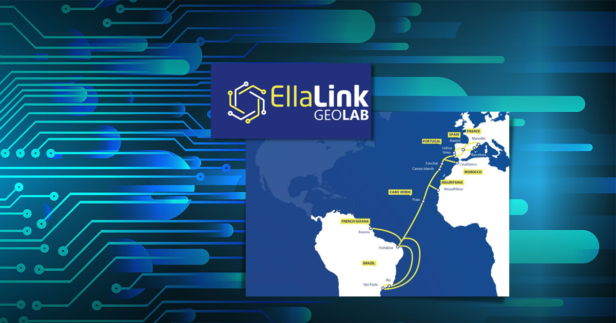
In May 2022, the Foundation for Science and Technology (FCT) and the EMACOM – Madeira Telecommunications signed a protocol to promote the use of fiber optics for research purposes – the first step towards the creation of GEOLab. Six months later, Orlando Frazão, a researcher at INESC TEC, coordinated the first research project to use the EllaLink GeoLab – an infrastructure created using the EllaLink submarine cable to study ocean floor conditions.
EllaLink GeoLab is supported by a third fiber installed in the branch to Madeira, owned by EMACOM, which also provides hosting services for the measuring equipment with DAS technology at the Amparo mooring station.
The management and operation of the experiences of EllaLink GeoLab is in charge of FCT, through the FCCN Unit, which ensures access by the research and teaching community to these resources, acting as “a glue that ensures communication between all participating entities and companies,” as Clayton Costa, from the FCCN Unit, says. Clayton Costa also highlights the strategic importance of the GEOLab project as an important step forward for Portugal, by allowing “regions that are not located on the continent to be the stage for new projects”.
We invited INESC TEC researcher Orlando Frazão to explain how these resources have contributed to scientific work, specifically the role that GeoLab's core technology can play in protecting the oceans.:

FCCN: How are GeoLab's resources important for the research you have been developing?
Orlando Frazao: Over the past few years, INESC TEC has developed and worked on projects in the area of distributed measurement, both in laboratory settings and in real-world situations. Close collaboration with the University of Alcalá has enabled the acquisition of knowledge about DAS (Distributed Acoustic Sensor) technology.
The need to find partners capable of utilizing this technology is one of the objectives of the Center for Applied Photonics. The collaboration with EllaLink GeoLab will allow DAS technology to be applied in real-world applications, specifically by leveraging the installation of submarine cables and their connection to DAS equipment to study various natural phenomena and human activities. The main objective of this research project is to monitor submarine cables located in Madeira using DAS technology. It also aims to analyze and compare the results obtained with DAS installed in various locations around the world.
FCCN: What results were obtained from GeoLab, and how is this knowledge relevant to ongoing research?
Orlando Frazao: The equipment is currently in data acquisition mode. Given the large amount of data to be stored, its analysis is complex and will take several months to complete. However, the knowledge gained will be crucial for understanding tidal and ship movements, and detecting microseisms.
FCCN: How do you assess the infrastructure coordination process? Are all expectations being met?
Orlando Frazao: The process of connecting with the infrastructure was complex, but the collaboration between the two partners has been excellent, and we hope that the system in operation will yield fruitful results by the end of the project.
FCCN: What do you think is the relevance of GeoLab within the national scientific system?
Orlando Frazao: I believe Portugal has a very important coastline, which is nothing more than a living laboratory full of potential for the development of scientific activities. It is also crucial to protect our coast, a process that, ideally, should be carried out 24 hours a day and in real time. DAS technology enables this monitoring, and we hope to demonstrate this feat at the end of the project. The future lies at sea, and I believe we should leverage our scientific community to enrich national and international science.